Public landscape · local life · river context
A park before
the river.
The green foreground at One River is not private landscaping. It is the 29-rai Bang Kho Laem side of a public waterfront park, paired with another 23 rai across the Chao Phraya. Bangkok uses it every day; online, the same place is scattered across one long formal name and several shorter aliases. We traced its design, public life and uneven discoverability—without turning a genuinely used park into a “secret.”
The short answer
Not hidden. Overlooked.
Bangkok formally lists it as the Public Park in Commemoration of H.M. the King's 6th Cycle Birthday (Rama IX Bridge). “Hidden gem” is close, but it tells the wrong social story. This is an official, well-used community park. What is hidden is its legibility to outsiders: a discreet approach below bridge infrastructure, a ceremonial formal name, and several competing aliases online.
A civic river park.
Bangkok classifies the adjacent 29-rai side as a community park. It is free and currently listed open from 05:00 to 21:00, with running, walking, river viewing, outdoor fitness and a playground.
Not a private amenity.
One River directly abuts the park, but the landscape remains public and independently managed on Expressway Authority land. No private resident gate or permanent view protection has been verified.
The city does not announce it loudly.
A 2003 post-occupancy study already recommended making the entrance and atmosphere more immediately visible to people passing on Rama III. That is historical evidence—not proof that nothing has improved—but the finding explains the enduring impression.
The place itself
Five views. One real public landscape.
Before statistics, see the place. Bangkok's current official image set moves from the river edge and bridge to the open lawn, shaded interior and running loop. The park is a sequence—not a green label on a map.
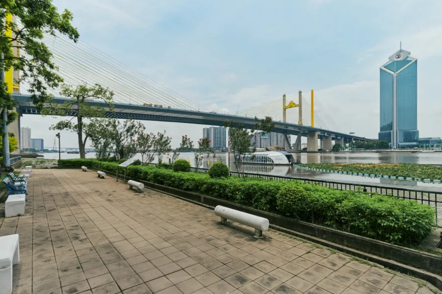
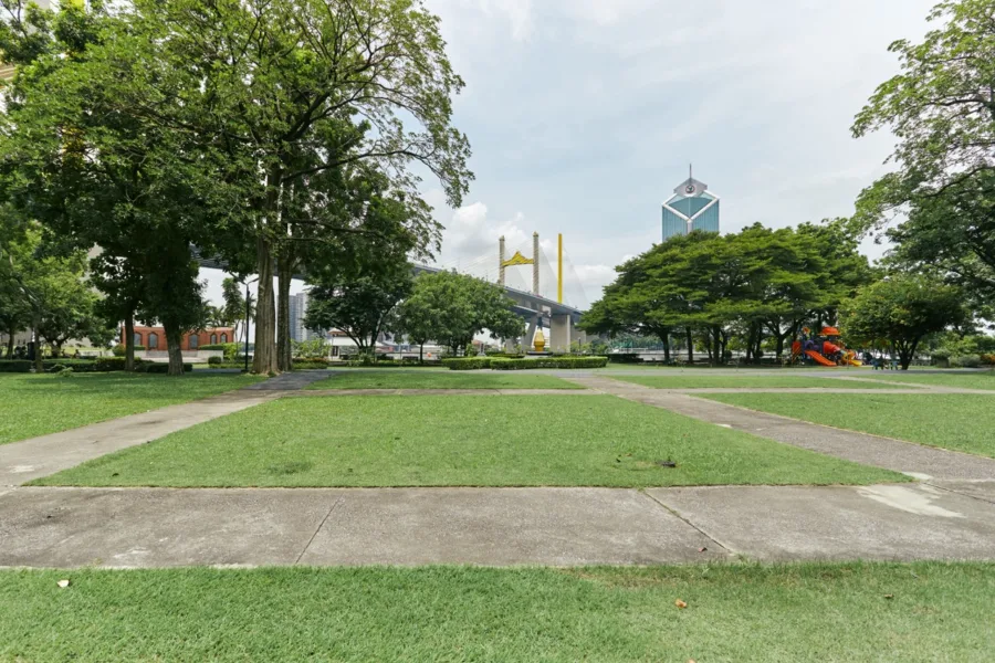
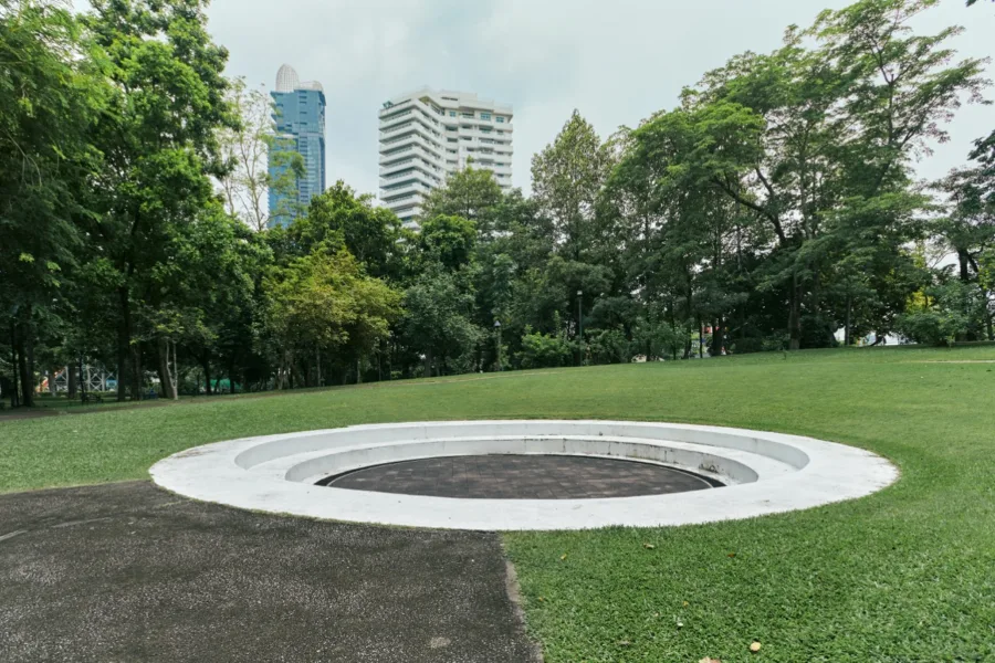
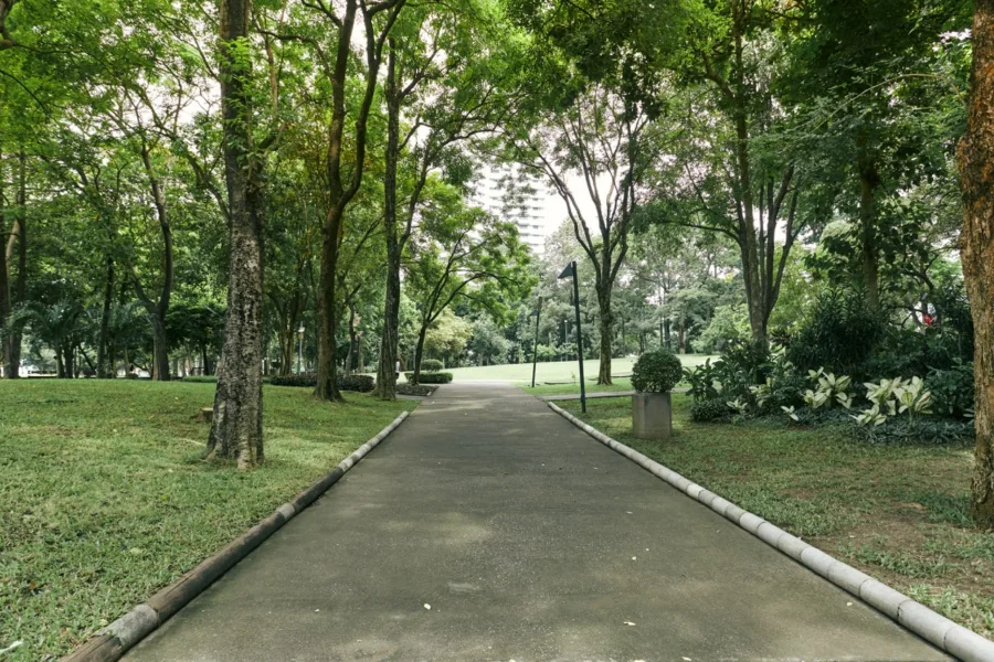
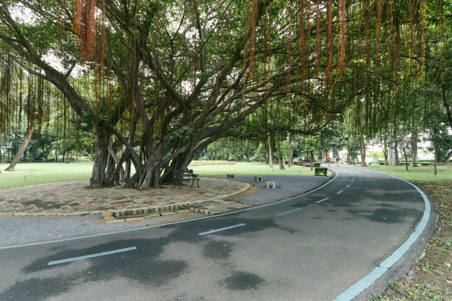
Official BMA photographs · remotely loaded from the official park record · not owned by 168 · no public reuse licence identified.
Plan a visit
The useful version, in one place.
Current public information checked on 19 August 2026. Hours, access, transport and rules can change; confirm them with Bangkok before travelling.
Listed open daily. Admission is free.
500 Rama III Road, Bang Khlo, Bang Kho Laem 10120. Bangkok advises approaching beneath the bridge and provides an official map point.
Running, nature walks, river viewing, outdoor fitness and a playground; the city also lists toilets and parking. Public transport routes should be checked on the official guide.
The current BMA listing prohibits pets, drones, smoking and alcohol. Respect other users, events, maintenance work and high-water controls.
One name · two riverbanks
The 29 rai beside One River is only half the composition.
Bangkok's riverside-land study describes one commemorative park in two pieces, separated by the Chao Phraya. The two figures are complementary, not competing measurements.
This is the east-bank landscape beside One River, historically described as the Phra Nakhon side: a nature-led, tide-aware waterfront park and the relevant green foreground for the residence.
Across the river, the paired western side was planned with a stronger sports and recreation emphasis. Together, the historical two-bank composition totals 52 rai.
Size is not the story
Lumpini is a city destination. Here, the luxury is position.
BMA lists Lumpini at 360 rai—about 12.4 times the adjacent park's area—and classifies it as a district-level park. The 29-rai riverside landscape is community-scale. It should not be sold as a smaller Lumpini; its distinction is that it begins where One River's riverward edge ends.
Circle area is proportional to BMA-listed park area. This compares scale only—not landscape quality, programming, ecology or experience.
The discovery paradox
Well used locally.
Lightly explained online.
A July 2024 BMA inspection described roughly 1,000–1,200 users on weekdays and 1,200–1,500 on weekends and holidays. Those are agency-reported ranges from that visit—not a permanent counter—but they are enough to reject the idea of an empty secret garden.
Discoverability is weaker than use. The formal Thai name is long. Bangkok also tells visitors to search for Suan 6 รอบ, while public references use Rama III Park, Rama IX Bridge Park, Suspension Bridge Park and other variants. International park guides rarely consolidate them.
The honest conclusion is more interesting than “hidden gem”: the park is part of local daily life, yet remains outside the usual international conversation dominated by Lumpini and Benjakitti.
A different kind of value
The park works as a daily rhythm, not a trophy amenity.
Its useful moments are ordinary: early exercise, tree shade, a river pause and the transition from green foreground to open water.
Morning movement
The park opens early. Running and walking are official uses; the BMA booking portal identifies 05:00–09:00 as one of its busier public periods.
Shade before water
The approved project context and controlled owner evidence support the sequence of canopy, river and skyline. Exact tree height, pruning and seasonal density will change.
A living river edge
The landscape was conceived around river and tidal phenomena. High-water management is therefore part of its reality, not a flaw to erase from the story.
A public closing time
The current listed closing time is 21:00. Public rules, events, maintenance and operating hours remain outside One River's control and may change.
What it means for 168
The rare part is not ownership. It is adjacency.
One River's official site lists the park at 0.0 km and markets a 29-rai park-and-river outlook. The stronger independent reading is spatial: the approved site context places public canopy along the project's riverward boundary, before the water.
That makes the park meaningful to the home without pretending it belongs to the home. It can shape daily routines, soften the foreground and hold the river at a more human scale. It also carries public realities: shared access, busy periods, changing trees, maintenance, events, river works and high water.
So, is it a hidden gem? For an outsider, perhaps it feels like one. For the people who use it, no. The better line is quieter and truer: Bangkok did not hide this park. It simply never made it easy to explain.
Method & sources
A place study—not an access or view guarantee.
We separated the adjacent 29-rai east-bank park from the historical 52-rai two-bank whole, compared areas using Bangkok's published statistics, and treated discoverability as an editorial inference supported by naming fragmentation and a dated access study. We did not conduct a current visitor survey.
The relationship graphic is schematic, not cadastral. No direct resident entrance, permanent park condition, perpetual view, fixed canopy height or guaranteed bridge visibility is represented.
Primary public records
- Greener Bangkok official park guide — formal name, current hours, fees, activities, rules and public access.
- Bangkok Statistics 2024 — 29-rai community-park classification and area comparison.
- BMA Chao Phraya riverside-land study — two-bank composition, land/management context and original landscape intent.
- Chulalongkorn University post-occupancy thesis (2003) — user satisfaction and historical entrance/access finding.
- BMA Environment inspection (16 July 2024) — stated use ranges and planting direction.
- Thai PBS (8 June 2017) — dated evidence of local users organising to protect the park during expressway works.
Uncertainty retained
- Visitor figures are agency-reported ranges, not live counts.
- The 2003 entrance finding may not describe every present-day condition.
- Public operations, access, vegetation, maintenance and river conditions can change.
- Public availability of source photography does not grant republication rights; this page uses original graphics instead.